Mount Fuji climbing routes
- Published on : 20/07/2018
- by : M.H.
- Youtube
The four paths
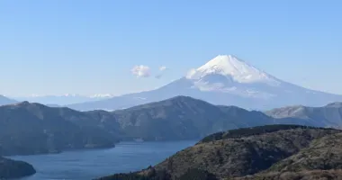
Mount Fuji, Japan's iconic landmark at 3776 meters, attracts thousands of hikers every year. To make a success of this memorable ascent, it's essential to be well prepared, to choose the right route for your abilities and to know the specifics of each itinerary. The trails are only officially open for a short period in summer, and require good physical condition and appropriate equipment. Let's find out together how to plan your ascent of Mount Fuji for a unique experience in complete safety.
Official climbing season and prerequisites
Climbing Mount Fuji is only possible during a limited season in summer, generally from early July to mid-September. The exact dates vary from trail to trail: the Yoshida trail is generally open from July 1 to September 10, while the other three trails (Fujinomiya, Subashiri and Gotemba) are accessible from July 10 to September 10. Outside this period, the trails are closed due to dangerous weather conditions, snow cover and the absence of rescue services.
Before considering a climb, make sure you're in good physical condition. Although climbing doesn't require you to be a professional athlete, it does demand the stamina to endure several hours' walking at altitude. Don't forget that at 3,700 meters, oxygen is scarce and your body reacts differently. It's advisable to avoid busy periods such as weekends, public holidays and the Obon period (mid-August), when trails can be extremely crowded.
Another important condition to take into account is the weather. Check the weather forecast before you leave, as conditions can change rapidly on the mountain. Sites like Mountain Forecast provide detailed forecasts for different altitudes. If rain, strong winds or thunderstorms are forecast, it's best to postpone your ascent for your own safety.
The four main ascent routes and their characteristics
Each route up Mount Fuji has its own characteristics and difficulties. Your choice of route will depend on your level of experience, physical condition and personal preferences.
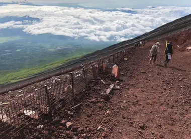
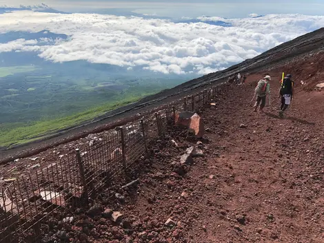
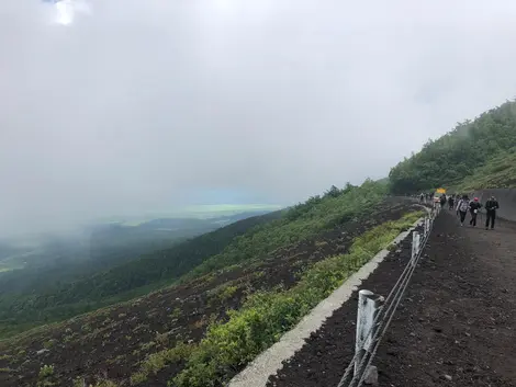
The Yoshida trail, located on the mountain's northern flank, is the most popular with 60% of hikers (172,000 people in 2017). Its popularity is due to its ease of access from Tokyo and the fact that it is designed to accommodate a large number of visitors. Starting from the 5th station at an altitude of 2,300 meters, this trail offers numerous huts and facilities. The ascent takes around 6 hours and the descent 4 hours. The route is relatively easy up to the 7th station, then becomes more rocky. It was along this trail that the Reportage team climbed Mount Fuji in July 2018. First-aid centers are available at the 5th, 7th and 8th stations, and the ascent and descent paths are different.
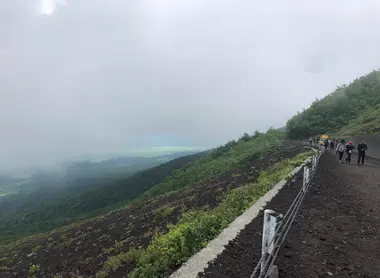
The Subashiri trail, on the eastern flank, starts at an altitude of 2,000 meters. Less frequented (23,500 people in 2017), it passes through a forest and offers a more natural experience until the 8th station, where it joins the Yoshida trail. The ascent takes around 6 hours and the descent 3 hours. This trail has a fairly gentle, wooded slope up to the 7th station, but has no first-aid center and few shelters before the 8th station. One advantage: you can see the sunrise right out of the trees, without having to reach the summit.
The Gotemba trail, the least frequented (18,000 people in 2017), starts from a much lower altitude (1400 meters) and therefore requires more time to reach the summit. The path is mainly covered by ancient lava flows with no vegetation. The ascent takes around 7 hours and the descent 3 hours. Despite its length, this trail offers the advantage of a rapid descent over smooth terrain. There is little infrastructure and no first-aid center.
The Fujinomiya trail, on the southern flank, is the second most popular (70,000 people in 2017) and the most accessible for people from western Japan. Its 5th station is the highest (2,400 meters), making the climb shorter (5 hours up, 3 hours down). On the other hand, the terrain is more rugged, rocky and steep, and the same path is used for both ascent and descent, which can create traffic jams. Huts are available at all stations.
For those unable to make the full ascent, the short Ochudo trail offers an interesting alternative. Instead of climbing, it crosses the mountainside horizontally. Once reserved for pilgrims who had already climbed Mount Fuji at least three times, this 5-kilometre trail is accessible from the 5th Yoshida station.
Preparation and equipment
Good preparation is essential for a successful ascent of Mount Fuji. The right equipment can make all the difference between an enjoyable experience and a real ordeal. Here's what you'll need:
For clothing, opt for several light layers rather than one thick one. Even in summer, temperatures at the summit can drop to 0°C, with the wind making it feel even colder. Make sure you have basic clothing that wicks away perspiration, insulating mid-layers and a waterproof, windproof outer layer. Don't forget a hat, gloves and possibly a neck warmer to protect you from the cold.
Hiking boots are a must. Choose models that protect your ankles, as the terrain is rocky, especially on the upper part of the mountain. Gaiters can be useful to prevent small stones from entering your shoes, especially on the descent.
Carry enoughwater and food for the duration of your hike. A minimum of 2 liters of water per person is recommended. Energy bars, dried fruit and other easy-to-carry snacks will help you maintain your energy levels. Be aware that you can buy water and food at refuges along the way, but at higher prices.
A headlamp is essential if you plan to make the ascent at night to see the sunrise from the summit, as many hikers do. You'll also need spare batteries.
Don't forget sun protection: high factor sun cream, sunglasses and a hat. At altitude, UV rays are more intense, and reflections off volcanic rocks can cause severe sunburn.
For your own comfort, remember to pack a small first-aid kit containing painkillers, blister dressings, a survival blanket and possibly medication for altitude sickness. For those suffering from altitude sickness, small oxygen cylinders are available for purchase in refuges.
And don't forget to bring some change (100 yen coins) to use the pay toilets along the trails and at the summit. A surgical mask may also be useful to protect you from volcanic dust on the descent.
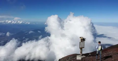
Our special envoy in contemplation
ABA
How to get to the starting point for your ascent
To begin your ascent of Mount Fuji, you must first reach the 5th station of one of the four main trails. Here's how to get there, depending on the trail you've chosen:
For the Yoshida trail, the most popular, you can take a direct bus from Tokyo (Shinjuku station) to the 5th Fuji Subaru Line station. The journey takes around 2h30 and costs around 2700 yen one way. During the climbing season, buses run regularly throughout the day, but it's advisable to book in advance, especially during peak periods. You can also take a train to Kawaguchiko or Fujisan, then a local bus to the 5th station.
For the Subashiri trail, shuttle buses run several times a day from Gotemba and Shinmatsuda stations during the climbing season. The 5th Subashiri station is mainly a parking lot with few services, but it's a less-frequented starting point for those seeking to avoid the crowds.
For the lesser-used Gotemba trail, buses leave from Gotemba station. The journey takes around 40 minutes and costs around 1,570 yen for a round trip. Buses run approximately every two hours between 7.35 a.m. and 3.50 p.m. to Mount Fuji.
For the Fujinomiya trail, accessible from western Japan, there are several options. Direct buses depart from Mishima station (on the shinkansen line between Tokyo and Kyoto) approximately every two hours, from 7.35am to 5.45pm. The journey takes about 2 hours and costs 3100 yen for a round trip. Buses also leave from Shin-Fuji, Fuji and Fujinomiya stations.
If you're coming by car, please note that all roads leading to the 5th stations are closed during the peak climbing season (July to September). You'll need to park in a designated parking lot and take a shuttle bus. For example, to reach Fujinomiya 5th station by car, you'll need to park in the Mizugazuka parking lot and take a shuttle or cab to reach the 5th station.
For more information on access routes, timetables and fares, visit the official Mount Fuji Climb website.
Huts and managing your climbing time
Managing your time and knowing your accommodation options is crucial to a successful ascent of Mount Fuji. Most hikers choose to spend a night in a refuge to acclimatize to the altitude and admire the sunrise from the summit.
Along all four trails, you'll find mountain huts offering overnight shelter. The Yoshida trail has the highest number of huts, particularly between the 7th and 8th stations. These establishments generally offer dormitories with futons lined up side by side. Comfort is basic, but they offer protection from the elements and a place to rest.
It's highly recommended to book your night in a refuge in advance, especially during the high season. Prices vary between 5,000 and 10,000 yen per person, depending on whether or not you opt for meals. Rates are generally higher at weekends and in huts located at higher stations.
For those wishing to see the sunrise (called "Goraiko" in Japanese) from the summit, here's a classic strategy: start the climb in the early afternoon, spend the night in a hut between the 7th and 8th stations, then finish the climb early the following morning to reach the summit before dawn. Sunrise is around 4:30 a.m. in July and 5:30 a.m. in September.
If you prefer to make the ascent in a single day, set off early in the morning to allow sufficient time for the ascent and descent. Allow around 6-7 hours for the ascent and 3-4 hours for the descent along the Yoshida trail. Allow more time if you take the Gotemba trail, which starts at a lower altitude.
During the ascent, adopt a slow, steady pace to avoid exhaustion and altitude sickness. Take regular breaks to rest, hydrate and nourish yourself. Don't hesitate to stop off at refuges for a hot meal or drink, even if you're not staying overnight.
For those sensitive to altitude sickness, it's advisable to spend some time at the 5th station to acclimatize before starting the ascent. Oxygen cylinders are available for purchase in refuges to alleviate the symptoms of altitude sickness, but the best solution is to descend if symptoms persist.
New regulations and compulsory reservations
Since 2024, new measures have been put in place to regulate visitor numbers and preserve Mount Fuji's environment. These changes mainly affect access to the Yoshida trail, the most popular, but will gradually be extended to the other trails.
From July 2024, access to the Yoshida trail will be subject to a fee. Permanent toll gates have been installed at the entrance to the trail, and an admission fee of 4,000 yen (approx. 25 euros) per person is now required. This fee will be extended to all trails from the 2025 season. Reservations can be made online on the official website, or on site, subject to availability.
The number of hikers on the Yoshida Trail is now limited to 4,000 per day, distributed as follows: 3,000 places are available for online booking, and 1,000 for on-site purchase. This measure is designed to improve the safety and comfort of climbers by preventing overcrowding on the trails.
To combat the phenomenon of "bullet climbing", the Yoshida trail is closed between 4pm and 3am. Only hikers who have booked a night in a refuge can access the trail during these hours. This measure is designed to reduce the risk of acute mountain sickness and exhaustion.
In addition to the mandatory admission fee, the authorities still encourage payment of the optional 1,000 yen for the preservation of Mount Fuji (富士山保全協力金). This voluntary contribution can be paid at the same time as the admission fee.
For the other trails (Subashiri, Gotemba and Fujinomiya), Shizuoka Prefecture plans to introduce similar restrictions in the near future. In the meantime, the authorities are checking that climbers starting their ascent after 4pm have a reservation at one of the refuges on the trail, and an online registration system has been set up.
These new regulations seem to be bearing fruit: in September 2024, the Yamanashi prefecture announced a 90% drop in the number of climbers doing bullet climbing at night, thus improving overall safety on the mountain.
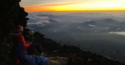
Set up for the show
TMA
Practical tips and climbing testimonials
For a successful ascent of Mount Fuji, here are a few practical tips based on hikers' experience:
Concerning the pace of your ascent, adopt a slow, steady pace. As Stéphane and Raphaël's experience testifies in Our dossier: Mount Fuji expedition, the climb becomes more difficult from the 8th station onwards. "Less air, the whole climb in your legs, lots of steps and very uneven terrain," they describe. The feeling of pride on reaching the summit more than makes up for the effort.
To avoid altitude sickness, hydrate regularly and take frequent breaks. Don't hesitate to stop at the 5th station for at least 30 minutes before starting your ascent, to allow your body to acclimatize to the altitude. If you experience symptoms such as headaches or nausea, rest and, if symptoms persist, don't hesitate to descend. Some hikers use small oxygen cylinders available in refuges to relieve symptoms.
As far as the weather is concerned, check the forecast before setting off, and be prepared to postpone your ascent if conditions are unfavorable. As one testimonial reminds us: "If they're forecasting rain at all levels, lots of wind, or thunderstorms, don't go up. Too bad, that's for another time. No climb is worth risking your life for."
For the descent, which can be hard on the joints, take your time and use walking poles if possible. "The descent is difficult too, the terrain is a mixture of sand, dust and small volcanic rocks. It's long and tiring!" say Stéphane and Raphaël. Knee pads can help relieve the pressure on your knees.
If you want to see the sunrise from the summit, plan your timing carefully. Check the sunrise time for the day of your climb and plan to arrive at the summit at least 30 minutes beforehand. Don't forget that the trails can get crowded near the summit, especially on the Yoshida Trail, which can slow your progress.
For those who prefer to avoid the crowds, consider climbing on weekdays rather than weekends, and avoid the Obon period (mid-August). Alternatively, consider the Subashiri or Gotemba trails, which are less crowded than Yoshida.
Finally, bear in mind that climbing Mount Fuji is as much a mental ordeal as a physical one. Prepare yourself mentally for several hours of continuous effort, and remember that perseverance is the key to success. As a Japanese proverb says: "He who climbs Mount Fuji once is wise, he who does it twice is a fool." For more tips on how to behave during the climb, see Climbing Mount Fuji, rules of good conduct.
Address, timetable & access
Address
Access
Yoshida: July 1 to September 10
Other trails: July 10 to September 10Website
http://www.fujisan-climb.jp/en/trails/index.html
