Michinoku Coastal Trail: The premier hiking trail of Tohoku
- Published on : 13/05/2025
- by : Lucie G.
- Youtube
Discover the Michinoku Coastal Trail, one of Japan's most beautiful hiking trails that spans over 1000 kilometers!
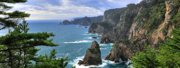
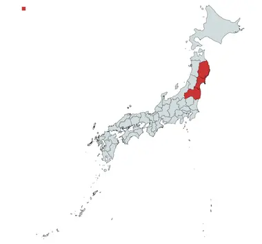
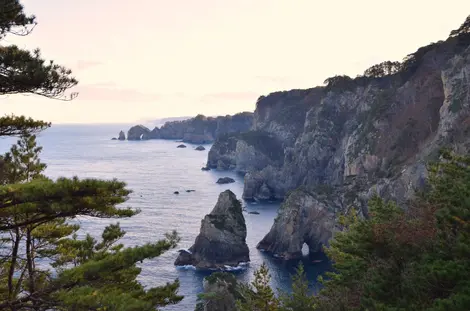
The Michinoku Coastal Trail, also known as the Tohoku Pacific Coast Nature Trail, is a very recent hiking trail, opening in 2019. The project came to be after the 2011 earthquake and tsunami, which hit Tohoku particularly hard, and the four prefectures crossed by the trail (Aomori, Iwate, Miyagi, Fukushima). It was therefore decided to merge the region's national parks and create a route inaccessible by car that would allow visitors to discover the impressive landscapes of the Pacific coast. The Michinoku Coastal Trail passes through Sanriku Fukko National Park, with its picturesque cliffs, unforgettable beaches and lush forests.
Contents
A trail marked by the 2011 disaster
The best time to hike the trail
What to see on the trail
The Pacific Coast Trail
The 1025 km Michinoku Coastal Trail starts in the town of Hachinohe, Aomori Prefecture, at the Kabushima Shrine, and ends in Soma, Fukushima Prefecture. It runs along the east coast of the main island of Honshu and is one of Japan's ten long-distance nature trails.
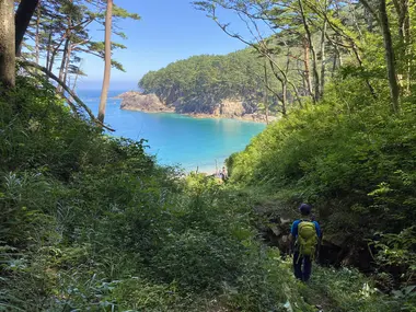
This extremely extensive hiking trail is predominantly flat (although the gradient can increase in places), and traverses a multitude of landscapes. From forest, to cliffs, to beach paths, this hiking trail offers some of the country's finest panoramas. The route is operated by the Michinoku Trail Club, a group of rangers who check that the trails are passable and keep hikers up to date with the latest information and warnings.
If you're an experienced hiker, you can tackle the 1,000 km that this route has to offer. In around two months, you'll have covered the entire Michinoku Coastal Trail! But if your stay in Tohoku is shorter, you can of course select a segment that you'd like to cover in just a few days. You'll find trails for all levels, and all of them will take you to some of Japan's most extraordinary places!
Michinoku Coastal Trail + points:
- Much of the route is juxtaposed with express train or bus lines (JR Hachinohe Line, Sanriku Line, Ofutano Line), making it easy to get around quickly between key points on the trail!
- Numerous hotels, campsites, and inns are located along the route, making it easy to find accommodation along the way!
- The trail passes through a multitude of villages, where you can discover stores selling local specialities, as well as restaurants and konbinis! For some sections of the trail, you don't even need to carry meals, as you'll be passing through villages!
- There are six information centers along the way, giving you all the information you need to make your stay as enjoyable as possible!
- Check out the 198 stamps scattered around the trail's landmarks.
- The Tohoku Shinkansen (high-speed train) from Tokyo passes through Hachinohe, the starting point of the trail, as well as Sendai further south. In the middle of the trail, you can reach Tokyo via Morioka or Iwate-Numakunai.
A trail marked by the 2011 earthquake
The trail was created following the 2011 earthquake on the Pacific coast of Tohoku, which resulted in a tsunami. The East Pacific coast of the Japanese archipelago was hard hit by the tsunami, which caused most of the material damage. This hiking trail was therefore an opportunity to pass on the history and educate travelers about the events, enabling the prefecture to rebuild and welcome back visitors. You can pass the Iwate Tsunami Memorial Museum, the Tsunami Memorial Park Nakanohama, or the Fudai sluice gate, which saved the eponymous village and its inhabitants from the flood.
As well as offering breathtaking scenery, local commerce flourishes in this part of Japan. There are many delicious local products to discover! Learn more about the culture and local food of the small towns you'll pass through, which will add to the charm of your stay! What's more, this quieter, more rural Japan makes it easier for you to mix and chat with the locals, who will teach you a lot about the region.
When to do the Michinoku Coastal Trail:
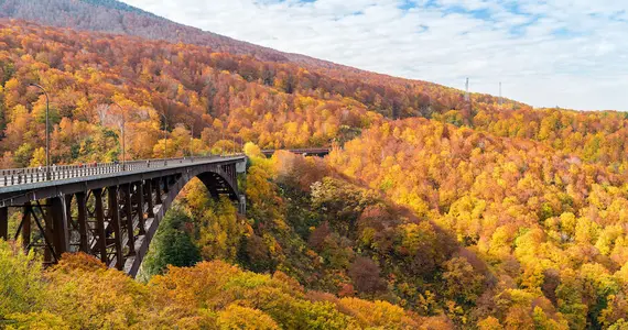
Spring and autumn are the two seasons in which we recommend you hike the Michinoku Coastal Trail. The weather and temperature are ideal during these seasons. What's more, some establishments (ferries, camping sites, etc.) are closed during winter. As summer on the archipelago is extremely hot and humid, some sections of the trail are not recommended during this season, although others are perfectly feasible.
What to see
The Michinoku Trail is packed with places to see, from landscapes to small temples and shrines in the midst of nature, and places steeped in the history of the 2011 disaster. Here's our selection of must-see places!
- Jodoga-hama Beach
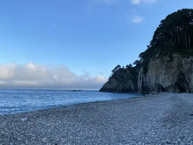
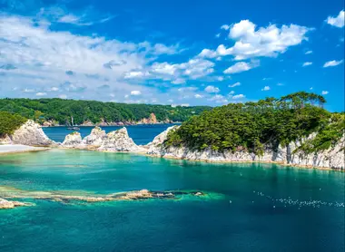
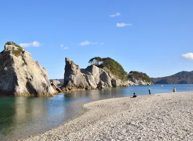
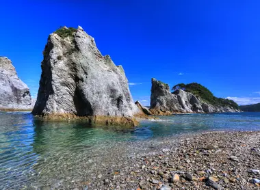
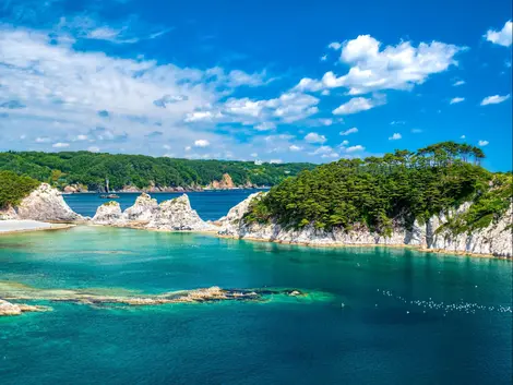
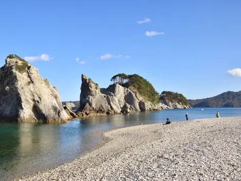
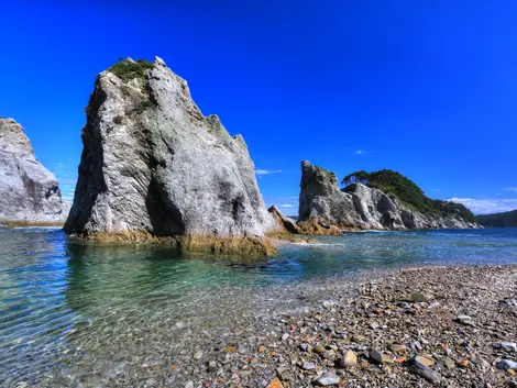
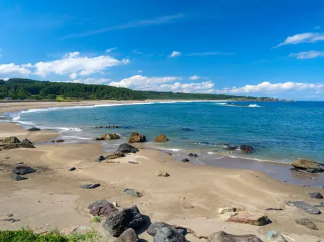
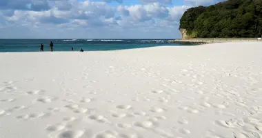
Located on the coast of Miyako, in the middle of the Michinoku Coastal Trail, this beach is one of the most beautiful on the main island, and indeed in the whole of Japan! Its mythical landscape of clear azure water and towering white rock formations makes this beach a must-see stop on the trail! Listed as one of Japan's 100 beaches and bathing places, Jodoga-hama beach is a splendid spot surrounded by pine trees. You can even go kayaking, or take a boat trip!
Where? Miyako
- Tanesashi Coast
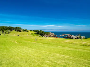
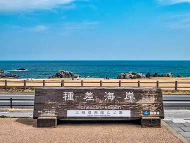
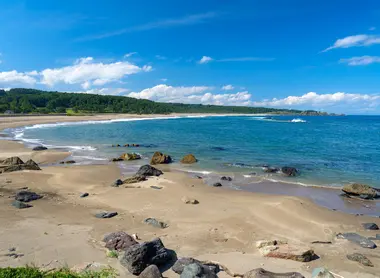
Near Hachinohe, this place is easily accessible and is classified as a National Scenic Beauty Spot. The walking path takes you along an absolutely splendid beach, which at times transforms into rocky shores. Some parts are laid out with large lawns for enjoying nature. To the south, from Takaiwa Viewpoint, the highest vantage point on the coast, the panorama is breathtaking.
Where? Hachinohe
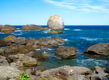
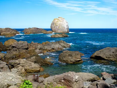
- Samurai Rock (Samuraiishi)
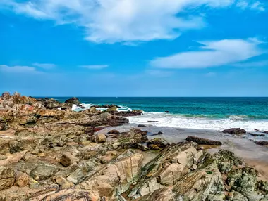
Samurai Rock is a rock formation that stretches along an entire stretch of the Kuji Prefecture coastline, and which you can walk on. These rocks are thousands of years old, and are said to have been trodden by the samurai Minamoto no Yoshitsune, hence the name Samurai Rock.
Where? Samuraihama
- Nedari Beach Nature Trail
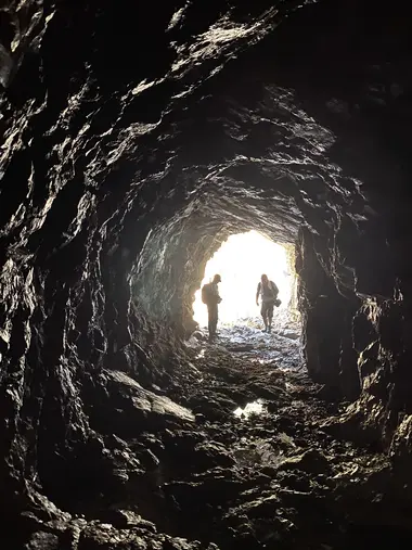
The path that leads you to this beach takes you along the black cliffs and up close to the ocean. The waves beside the path break on the dark rocks, contrasting with the blue of the water. This trail also takes you through a man-made tunnel in the rock, which transports you into a world completely different from the others. Higher up, there's the Kurosaki viewpoint, and a little to the north, the fishing port of Kirosaki, both of which are must-sees if you're passing through Nedari Beach.
Where? Fudai
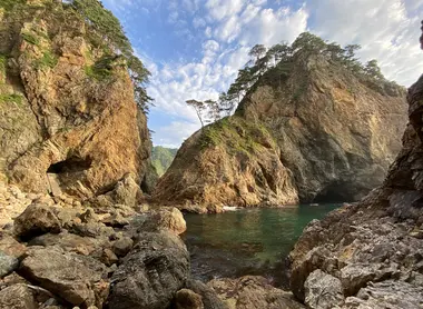
- Kitayamazaki Cliffs
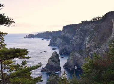
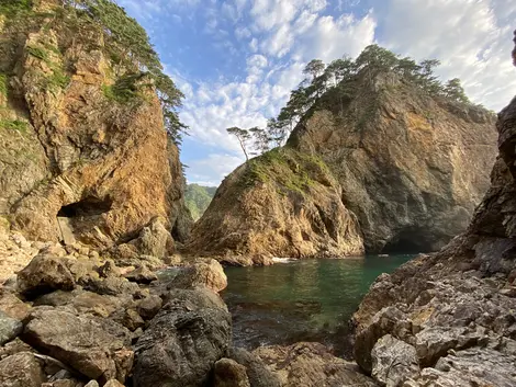
The Kitayamazaki Cliffs are one of the most emblematic spots on the Michinoku Coastal Trail. Also known as the "Alps of the Ocean", these 200-metre-high cliffs offer spectacular views of the ocean and rock formations cloaked in vegetation. There are several viewpoints along the trail from which to admire this breathtaking landscape. The cliffs stretch over 8 km of the archipelago's east coast, and are part of Sanriku Fukko National Park.
Where? Tanohata
- Unosu Cliffs
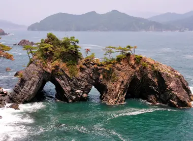
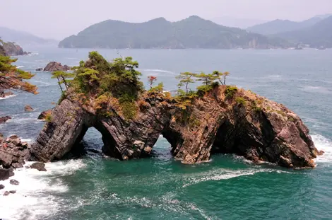
Next to the Kitayamazaki cliffs are the equally spectacular Unosu cliffs. You can admire the waves of the Pacific Ocean breaking on the large rocks, and the lovely rounded shapes of these vegetation-covered cliffs. The area is also home to many bird species, including the cormorant.
Where? Tanohata
- The Goishi Coast
The name Goishi comes from the go game stones, which resemble wave-polished rocks. It is the Kaminari iwa (Thunder Rock) that makes this absolutely heavenly place so special. In fact, Japan's Ministry of the Environment has named it one of the 100 natural sounds of Japan, for the characteristic sound of waves breaking on the rock.
Where? Ofunato
Our recommended segments
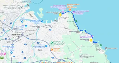
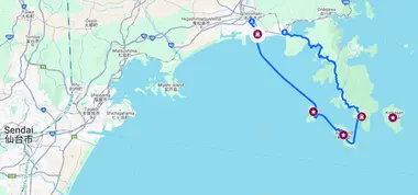
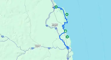
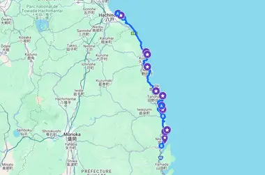
We suggest various itineraries along the Michinoku Coastal Trail. Please note, however, that these are not the only options available, and that there are a multitude of possible routes ! Here, our few itineraries suggest a starting point, an end point and the various key points to discover along the way. Please note that the maps presented here do not show the actual route of the trail. Visit Michinoku Trail Club website for details of the route.
Accessible to beginners:
- Hiking close to town
🧭 Starting point/ending point: Hachinohe → Tanesashikaigan
🏞️ Key point crossed : Tanesashi coast
🥾 Number of kilometers: 10 km
⏱️ Approximate walking time: 2 hrs 30 mins (doable over a day)
- Miyagi Islands Tour
🧭 Starting point /ending point: Ishinomaki Station → Watanoha Station
🏞️ Key points crossed: *kinkasan Island, Oshika Peninsula, Tashirojima Island, Aji Island
🥾 Number of kilometers: 25 km
⏱️ Approximate time: 3 days
*Ferry trips to be booked in advance!
Accessible to intermediate walkers:
- Fudai to Iwaizumiomoto
🧭 Starting point/ending point: Fudai → Iwaizumiomoto*
🏞️ Key points crossed: Kitayamazaki Cliffs, Unosu Cliffs, Shimanokoshi boat trip, Fudai Floodgate
🥾 Number of kilometers: 35 km
⏱️ Approximate time : 3 days
*From Iwaizumiomoto, you can reach Miyako in 50 minutes on the Riasu line, where there is plenty of accommodation.
For experienced walkers :
- Sanriku Coast Trail
🧭Start/finish point: Hachinohe → Miyako
🏞️ Key points crossed: Kitayamazaki cliffs, Unosu cliffs, Tanesashi coast, Samuraiishi, Kosode coast, Jodoga beach
🥾 Number of kilometers: 250 km
⏱️ Approximate time : Two weeks
Discover the Tohoku coast by train with our 5-day excursion!
Practical information and good conduct on hiking trails
Here are a few tips for exploring the Michinoku coastal trail :
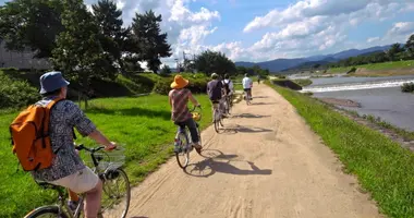
- On the way, there are several establishments that let you rent bicycles, so take advantage of the opportunity to cycle part of the trail, since most of it is paved!
- Don't hesitate to hire fishing boat excursions to cruise the Pacific and admire the cliffs and rock formations you've crossed from the sea! Our recommended locations are Miyato, Kitayamazaki Cliffs, Kinkasan, Urato Islands and Miyagi Islands.
- Three train lines roughly follow the walking trail! So don't hesitate to make part of the journey by train, and select the segments that interest you for walking!
Our walking tips:
- Choose hiking boots, because even if the terrain is in fairly good condition, walking for hours in unsuitable footwear can end up being painful!
- The trail alternates between urban and wilderness areas. Tap water is drinkable in Japan, so you can fill your water bottles in any establishment (hotel, restaurant, information center...). What's more, Japan is the land of vending machines! You'll come across them frequently in urban and populated areas.
- When you meet someone, always greet them by saying hello in Japanese "konnichiwa".
- Don't leave litter lying around, and respect nature.
